Welcome to Brett and Emily´s travel blog.

I promise I will finish updating soon...7 more post to do!

July 13, 2010: Banos updated (pics soon)

June 23,2010: Lima and Mancura are finished (in reality Mancura was already finished but I wanted to post them in order so I need to finish Lima) with pics

June 22, 2010: I know, I know...I have been home for a month and a have a lot to update from South America. Well the Amazon was updated today with pictures!

Monday, May 17, 2010

Emily´s visit to Sexy Women oh wait Sacsayhuamán

Just above Cusco is a large scale archeological site that ios filled with both pre-Incan and Incan ruins.  Sacsayhuamán (or literally pronounced as Sexy Women) is located just a 5 minute drive from Cusco.  A few days after we returned from Machu Pichu I was feeling a bit under the weather so Emily went and visited it herself...these are her photos.


Overlook of Cusco


Why Emily is a wanted by PETA

The following is a sequence of photos of Emily trying to hug a baby llama at Machu Pichu.  Most of the adult llamas were very friendly to human beings, the baby llamas still kind of scared.  Anyway in the end Emily basically molested this poor baby llama so she could attempt to take a picture of it.  Emily claims it was ´LOVE,´ but I was there and witnessed it all.  If there was love it was not resipricated by the baby llama.  The ordeal finally ended when the mother llama made a noise at Emily and then the family ran off.

ENJOY...

 The baby llama has been spotted and is cornered

Emily trying to catch it as it runs away

Emily forcably grabbing the baby llamas neck in an attempt to take a picture

The baby llama gives an odd look at Emily, this is about the point where the momma llama made a odd noise at Emily

The llama family running away from Emily after she molested their baby

Machu Pichu...WOW!

Machu Pichu...Wow is really all I can say about the site.  I am not even going to try and fully explain the site, my words just wouldn´t do justice.  I will however give a brief history of the site and also what we did the day we visited the ruins.

First the history...
In reality Machu Pichu doesn´t hold a large amount of significance in Incan history.  Cusco was the true capital of the Incan Empire and yes with Machu Pichu close vicinity to Cusco it did hold its share of wealth and religious sanctuaries.  The reason why Machu Pichu is so significant today is because of its relativley undamaged ruins and also because of its relative easiness to access.  In reality no one knows the actual towns name, when Hiram Bingham discovered the ruins in 1911 his local porters told him that the true name of the city had been lost but the mountain that the city is built on, along its slope, is called Machu Pichu.  In reality Bingham was actually looking for another lost Incan city, Vitcos or Vilcabamba, which was the last stand evidently between the Incans and the Spaniards (the site was eventually found in the 1980s and is larger then Machu Pichu but requires a 2 day trek in and 2 day trek out to get (no roads go anywhere near the ruins).  The site was built in the mid 1400s and was probably inhabited for just over a hundred years until the Spanish came through the region.  In reality the time the Spaniards came and destroyed the Empire, it was almost on the verge of collapse from civil war.  The the mid 15oos when the Emperor died he decided to split the power of Emperor to his two eldest sons.  Basically neither of them liked this and for years had been battling each other and basically destroying the empire from within.  The reason this site, especially its religious areas, are not destroyed is because it is believed the Spaniards never found Machu Pichu.  The legend goes that all 7 entrances to the city were destroyed and the city was basically abandoned.  This is why the site is basically in perfect condition, unlike sites we visited in the sacred valley or Cusco which was completely destroyed and rebuilt.

Now what we did...
We continued our early morning wake ups and because we are all cheap instead of paying for the $8 bus ride up to the entrance of Machu Pichu at 6am we decided to start hiking the 1,000+ stairs at 4:30am.  When we finally got to the top our group was one of the first groups of people up (my entrance ticket to Machu Pichu said I was the 15th person to enter that day).  After eating some muffins I purchased the night before in Aguas Calientes we finally entered the park around 6:30 (the reason we wanted to be there early was so we could get one of the 400 coveted spots to climb Huayna Picchu mountain (the famous mountain you normally see in the background of pictures of Machu Pichu).  We headed to a great overlook near the top of the city to watch the sunrise.  After the sunrise we went on a 2+ hour tour with our tour guide from the trek and he showed us many interestings sites and gave us a detailed history the Incas and Machu Pichu.  One interesting thing we learned during this tour was the city even though it has gone through dozens of earthquakes is relativly protected well from earthquake damage and landslides from heavy rain because of the way the buildings are built angled and also the terraces throughout the site.  After our tour we hiked up another I don´t even know how many stairs (well over 500 though) to the top of Huayna Picchu which gives you a great overlook from a different angle of Machu Pichu.  We enjoyed our lunch on top of the mountain (which we purchased the night before in the town market).  After heading back down and exploring the rest of the site we settled down on a grassy terrace area and just enjoyed the ruins.  We also hiked out to this little area around the side of Machu Pichu mountain called the Inca Bridge.  Which was one of the entrances to Machu Pichu, that had a large gapping hole that most researchers believed use to have large tree trunks laying across that could be removed in case of attacking armies.  The missing bridge today leaves a huge fall of the side of the cliff.  Around 5pm we headed back to Aguas Calientes and had about 4 hours to kill before our train left back to Cusco.

Sunrise at Machu Pichu

 Early morning

 The mountain in the background is Huayna Picchu

 Group shot

Llama Love

The Llama doesn´t look amused that I´m trying to kiss him


Terraces

Temple to the Sun God...The windows are exactly lined for the winter and summer solices


Checkout that polished and fitted rocks


 The main town square

Several Agricultural Terraces


  Huayna Picchu

 The Kiwis hiking up Huayna Picchu

View of Machu Pichu from the top of Huayna Picchu 
Scary looking bunny/squirrel animal


Sun starting to go down

The Inca Bridge that use to be connected by large logs

View of the Valley we walked down the day before


The famous three windows temple

View from the top of Huayna Picchu down onto Machu Pichu


Main Temple of the complex (behind this is a Lunar Temple, which was partially damaged in the 1990s when a beer company was shooting a commericial and a crane fell)

Like I said the visit to Machu Pichu was amazing and there is no true way of describing it.  IT´S A MUST SEE!  I 100% understand why it made the new 7 Wonders of the World List (which I have now visited 4, the other three being: Christ the Reddemer in Rio, Brazil; Petra, Jordan; and the Pyramids in Egypt).

Hiking the Salkantay Trail

Our hike to Machu Pichu was along a path known as the Salkantay Trail.  In the last post about Cusco I explained all of our options for getting to Machu Pichu and after discussing our options with our friends Sophie and Dean we had decided upon this trek and signed up with a company.  The trek was a 5 day/4 night trek that took us through some amazing terrain.  Our group had 16 trekkers (us, Sophie and Dean, 2 British couples, 2 friends from New Zealand, another Brit, an Aussie, a Spanish couple, and 2 friends from Brazil), plus our two guides, 2 cooks, and 2 porters.  Unlike the Inca trail which does not allow horses/donkeys/mules, the Salkantay trail does so the two porters effectivly just loaded up the donkeys everyday and also setup our tents for us and took them down everyday.  Also our cooks were amazing!  The food was better then anything I could have ever made while I was trekking and every morning when we had to wake up at 4:30 or 5:00am they were right at our tent doors with a hot cup of coca tea!

Quickly I will just give an overview of the trek and then just upload a bunch of photos. 

For further explanation from one of many tour companies you can check out this link...SALKANTAY TOUR

Day 1)  We arrived in the morning in a small town, Mollepata, where we met up with our porters (who are from the town), the cooks and guides were from Cusco.  The majority of the first day was steady uphill starting probably around 2,900m and ending at 3,800 over the course of 6 hours.  The majority of the trail was on a dirt road that basically ended at our first camp site (I think the total hiking for the day was 20+km).

Pictures after we arrived at our first campsite of both Salkantay and Umantay Mountains...

 Salkantay

 Salkantay

 Salkantay

 Crossing in to the first campsite

A porter unloading one of the donkeys at the campsite, with Umantay Mountain in the background

Dean, Sophie and Emily during our dirst day hiking

Day 2)  This was the difficult day.  First we woke up really early.  The main reason was we had to trek from 3,800m to 4,600m in a very short time and our guides wanted us to finish all the uphill before the sun really came out.  The top point was to an area known as the Salkantay Pass (the lowest possible area to pass between the Salkantay and Umantay Mountains.  It also had an amazing view of the Salkantay Mountain, even though when we got to the top of the pass we couldn´t see the peak of Salkantay or Umantay (we were able to see them the day before and watch them disappear during the sunset).  We also had the great pleasure of being able to view a pretty amazing avalanch of snow and ice come down from a glacier on Salkantay.  From this point which we hit by 10am (I think the whole uphill was just over 2 hours, but 800 meteres straight uphill in that time is not to fun but less hard as the whole group thought).  We spent the rest of the day descending a valley until we hit the campsite in the late afternoon and beginning to see the huge change in landscape from an almost tundra like terrain near the mountain pass to the border of the rainforest.  The day in whole was only about 18km of walking but that first part was no picnic.

 Myself, Sophia, Emily, and Dean after the 800m uphill (Dean was to lazy to jump)

 Dean, Sophie (holding a picture of our friend Nuno from our Salt Flats trip), Emily and I at the top of the Salkantay Pass

Great view of the valley past the Salkantay Pass

The Avalanch that occured while we were taking pictures at the top

Descending down in to the jungle (pretty cloudy)

Check out the cool colors of the flowers and rocks

Check out the cool colors of the flowers and rocks


 Entering the Jungle

Wild Strawberries!!  They were delicious!

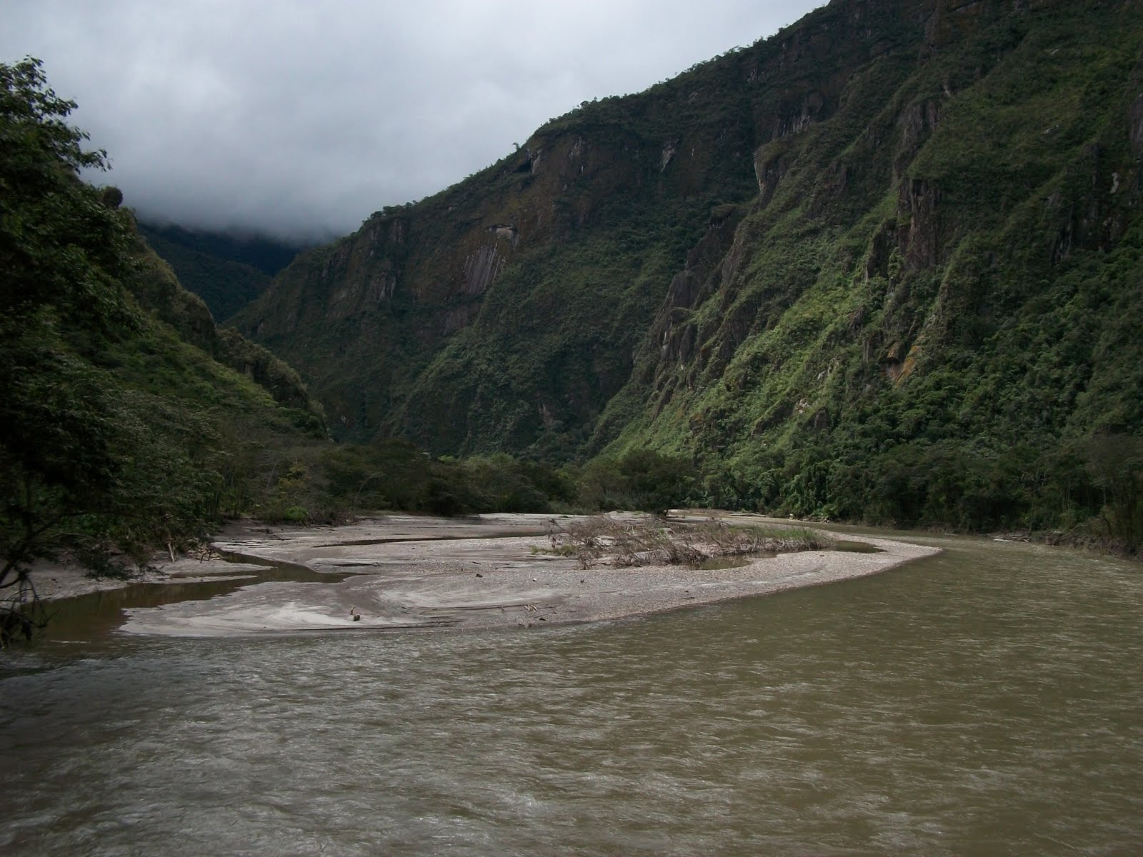
Day 3)  Walking the what is considered the highest point and beginning of the Amazon basin.  WOW!  The flora was absolutley amazing as you could see from two post ago with the collection of flowers.  It was also so weird how the day before we were in such cold terrain and not more then a few kilometers away we were in the jungle.  The day was mainly descending through amazing jungle scenery and getting some cool picks at several waterfalls.  That night we camped at our final campsite (and said goodbye to our porters who returned back to the original town).

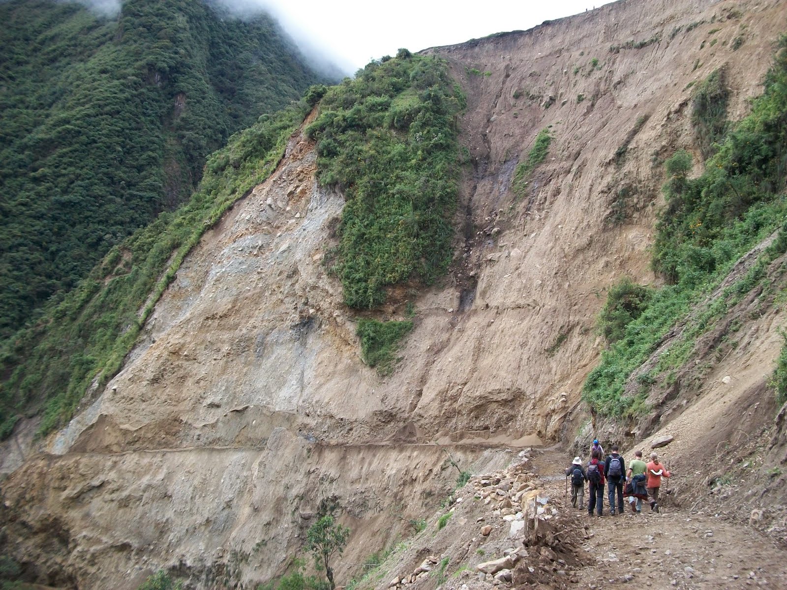
Result of January mudslides

 Us on a bridge

The jungle

Another bridge next to a waterfall

Look carefully at that leaf that is not another leaf on top of it

Craziest Turkey I ever saw

In January this river was much much larger (also another landslide from the January rain)

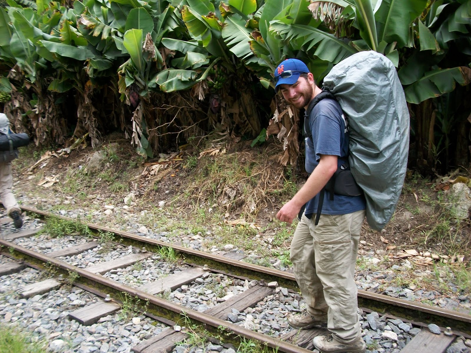
Day 4) Evidently before last January our trek use to head to the town of Santa Teresa (which is famous for its hot springs) and then you would either hike along train tracks to Aguas Calientes (the town below Machu Pichu).  However, this past January because of the affects of El Niño the hot springs in Santa Teresa were almost completely destroyed when the river that runs past the town swelled to record levels and basically destroyed everything along the banks of the river.  Luckily the town itself was not destroyed, this had happened in the 1990s during one El Niño and the town had to be rebuilt near the old town but higher up.  Also during the previous few days we had been able to see several affects of the damage the bad rainy season in January did to the region including several remains of landslides throughout our trek.  Are guide had also told many of us about how the last trip he led right when all the land slides happened he was stuck in Machu Pichu for 3 days for his group he led was helicoptered out.  Becuase the route to Santa Teresa was no longer possible the guides gave us two options.  If we wanted to we could leave early and hike up a large mountain (with a possible overview of Machu Pichu from a distance) or we could take a bus to a river crossing point where we crossed the river about 40 meters over the river in a small metal basket.  Emily and I chose the second option and had a pretty enjoyable time crossing the river.  After this point we had another 3 hour hike into Aguas Calientes.  We finally arrived and after showering our entire group had a large dinner at a resturant connected to our hotel (that the trekking company paid for).  We headed off to sleep many of us anticipating the next morning...Machu Pichu!

The metal basket going over the river

 One of the groups going over the river before us, these Gringos decided to go over in style

We do have a video of us going over the river in the basket, maybe eventuallyI will be able to upload it

Water pouring out of the mountain side from a nearby hydroelectric plant

Another waterfall created by the hydroelectirc plant

Walking on the train tracks


Can´t really tell from the photo but in the distance on the mountain side are some ruins from Machu Pichu